By Alesha Capone
Two Werribee historic sites, including trees and features from a century-old property previously owned by the Chirnside family, are set to be placed under heritage planning controls.
Wyndham council last month voted to ask the minister for planning for permission to have parts of the former Manor estate and some homes in the Carter Avenue Precinct included in a heritage overlay amendment to the municipality’s planning scheme.
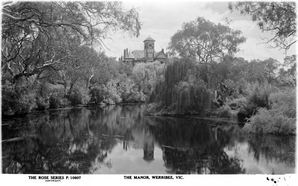
The Manor was built by Percy Chirnside, son of pastoralist Andrew Chirnside, in 1895-1896.
The 40-room house, which was used as a RAAF hospital in World War II, burned down in 1966.
The council has moved to include surviving trees and remnants of a stone retaining wall into its heritage overlay so they will be protected under the Planning and Environment Act.
A horse trough and archaeological remnants such as stepping stones in the Werribee River, a pump and well, will be included in a statement of significance in the Wyndham planning scheme.
Sections of Wattamolla Avenue, Quarbing Street, Werribee Street North and Guyra Court, which are now where The Manor estate once was, will be covered by the overlay and statement.
In Carter Avenue, dwellings, integrated garages, facades and front fences at 12 residences will be included in the heritage overlay after a study found they are of “local significance”.
The residences, developed by architect WJ Bliss in the 1940s, were constructed as part of a housing estate for the Carter Brothers’ factory employees.
In 1918, the Carter family established a poultry company in Werribee, which became one of the biggest in the world in its era.
Cr Heather Marcus has also requested that North and South base stones – which date from the 1800s – be fenced off for protection.
The stones, on the north side of Princes Highway, Hoppers Crossing and the south of Sayers Road, were used as markers in the Geodetic Survey of Victoria, which mapped the entire state.
Cr Peter Maynard said the council has previously been unsuccessful in purchasing land to allow public access to the South base stone.


