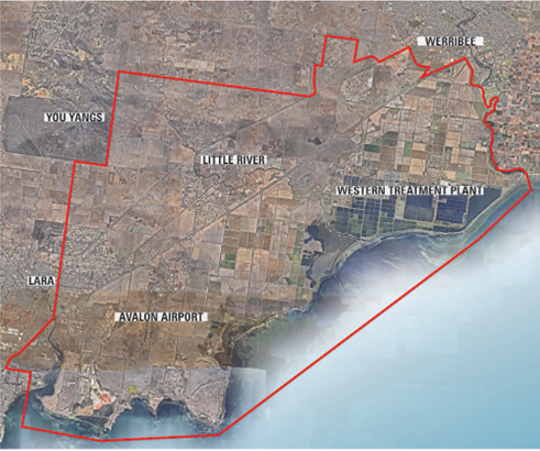
The future of Avalon Airport and surrounds is going under the microscope.
Wyndham council is joining Geelong council and the state government to map out future development for land between Lara and Werribee, dubbed the “Avalon corridor”.
The three bodies have appointed a consultant team to prepare a strategy that will guide the future use of the land, which encompasses Little River, Avalon Airport and the Western Treatment Plant.
An Environment, Land, Water and Planning spokesman said the team would consider a range of options and opportunities for potential land use, economic development and employment.
He said the corridor included significant state and national assets and infrastructure.
“The corridor also contains significant agriculture, environmental and landscape values,” he said.
“There is a need for a clear strategic direction for the future of the corridor.”
Wyndham economy, innovation and liveability director Kate Roffey said that as one of two councils immediately affected by the future of the Avalon corridor, it was important that Wyndham had a say in the development of the strategy.
“This area is facing changes in the future, with plans for transport links like the Outer Metropolitan Ring and the Avalon Rail Link, along with planned development around Avalon Airport,” Ms Roffey said.
“It is important that a plan is developed to ensure we can respond to these changes. The strategy will address how this land is used and will cover a number of areas, including the environment and heritage of the Avalon corridor, economic and employment, flooding and drainage, and the opinions of the community.”
The project team is currently conducting community consultation, with a view to releasing a draft plan towards the end of this year.
To have your say, click here


